
Municipio Páez topographic map
Interactive map
Click on the map to display elevation.
About this map
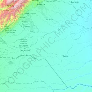
Name: Municipio Páez topographic map, elevation, terrain.
Location: Municipio Páez, Apure, Venezuela (6.93395 -72.41702 7.79152 -69.61170)
Average elevation: 823 ft
Minimum elevation: 203 ft
Maximum elevation: 15,948 ft
Other topographic maps
Click on a map to view its topography, its elevation and its terrain.
Parque Nacional El Tamá
Parque Nacional El Tamá, Municipio Páez, Apure, Venezuela
Average elevation: 2,841 ft
El Samán de Apure
Venezuela > Apure > El Samán de Apure
El Samán de Apure, Municipio Achaguas, Apure, Venezuela
Average elevation: 220 ft