Geolocate

Waikawa topographic map

Click on the map to display elevation.

About this map

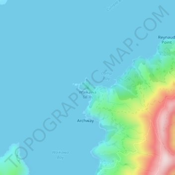
Name: Waikawa topographic map, elevation, terrain.

Location: Waikawa, Marlborough, New Zealand (-40.95402 173.80793 -40.95392 173.80803)

Average elevation: 161 ft

Minimum elevation: 0 ft

Maximum elevation: 1,266 ft

Other topographic maps

Click on a map to view its topography, its elevation and its terrain.

Gear up for your next adventure:

📻Weather Alert Radios - Stay informed of storm risks while off-the-grid
🎒Trekking Poles - Sturdy poles for balance and stability on rough terrain
🕶️Glacier Sunglasses - Side shields to protect eyes from high-altitude snow glare
🚁Photography Drones - Capture stunning aerial views of landforms and topography
🪶Wildlife Field Guides - Learn animal tracking and species ID

As an Amazon Associate, this site earns from qualifying purchases at no extra cost to you.