
Thank you for supporting this site ❤️
Make a donation
Make a donation
Gear up for your next adventure:
As an Amazon Associate, this site earns from qualifying purchases at no extra cost to you.
Salceda topographic map
Click on the map to display elevation.
Thank you for supporting this site ❤️
Make a donation
Make a donation
Gear up for your next adventure:
As an Amazon Associate, this site earns from qualifying purchases at no extra cost to you.
About this map
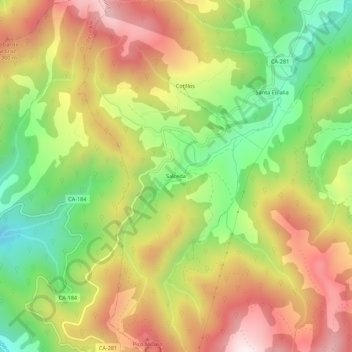
Name: Salceda topographic map, elevation, terrain.
Location: Salceda, Polaciones, Cantabria, 39557, Spain (43.05997 -4.47830 43.09997 -4.43830)
Average elevation: 3,757 ft
Minimum elevation: 2,602 ft
Maximum elevation: 4,951 ft
Thank you for supporting this site ❤️
Make a donation
Make a donation
Gear up for your next adventure:
As an Amazon Associate, this site earns from qualifying purchases at no extra cost to you.