
Montclair topographic map
Click on the map to display elevation.
About this map
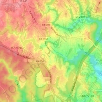
Name: Montclair topographic map, elevation, terrain.
Average elevation: 200 ft
Minimum elevation: 13 ft
Maximum elevation: 341 ft
Prince William County trails, hiking, mountain biking, running and outdoor activities
Other topographic maps
Click on a map to view its topography, its elevation and its terrain.
Chamberlain Village
United States > Virginia > Prince William County > Quantico > Chamberlain Village
Average elevation: 52 ft
Bull Run Mountain Estates
United States > Virginia > Prince William County > Bull Run Mountain Estates
Average elevation: 646 ft
Silver Lake Regional Park
United States > Virginia > Prince William County > Haymarket
Average elevation: 430 ft
Occoquan Bay National Wildlife Refuge
United States > Virginia > Prince William County > Woodbridge
Average elevation: 10 ft