
Thank you for supporting this site ❤️
Make a donation
Make a donation
Gear up for your next adventure:
As an Amazon Associate, this site earns from qualifying purchases at no extra cost to you.
Cubas topographic map
Click on the map to display elevation.
Thank you for supporting this site ❤️
Make a donation
Make a donation
Gear up for your next adventure:
As an Amazon Associate, this site earns from qualifying purchases at no extra cost to you.
About this map
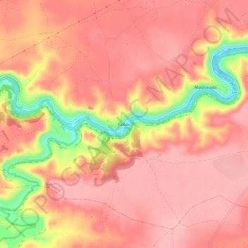
Name: Cubas topographic map, elevation, terrain.
Location: Cubas, Jorquera, Albacete, Castilla-La Mancha, 02249, España (39.13619 -1.60065 39.17619 -1.56065)
Average elevation: 2,149 ft
Minimum elevation: 1,827 ft
Maximum elevation: 2,264 ft
Thank you for supporting this site ❤️
Make a donation
Make a donation
Gear up for your next adventure:
As an Amazon Associate, this site earns from qualifying purchases at no extra cost to you.