Geolocate

Pontepietra topographic map

Click on the map to display elevation.

About this map

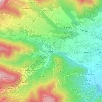
Name: Pontepietra topographic map, elevation, terrain.

Location: Pontepietra, Giaveno, Torino, Piemonte, 10094, Italia (45.02164 7.29743 45.06164 7.33743)

Average elevation: 2,221 ft

Minimum elevation: 1,581 ft

Maximum elevation: 3,192 ft

Gear up for your next adventure:

🥾Men's Hiking Boots - Durable, waterproof footwear for rugged terrain and steep inclines
🌄Hiking Binoculars - Compact binoculars for scenic views and trail spotting
🥾Hiking Shoes - Durable and comfortable shoes for trail hiking
🔦LED Headlamp - Bright and durable LED headlamp for night navigation
🪶Wildlife Field Guides - Learn animal tracking and species ID

As an Amazon Associate, this site earns from qualifying purchases at no extra cost to you.