
Thank you for supporting this site ❤️
Make a donation
Make a donation
Gear up for your next adventure:
As an Amazon Associate, this site earns from qualifying purchases at no extra cost to you.
Ilıca topographic map
Click on the map to display elevation.
Thank you for supporting this site ❤️
Make a donation
Make a donation
Gear up for your next adventure:
As an Amazon Associate, this site earns from qualifying purchases at no extra cost to you.
About this map
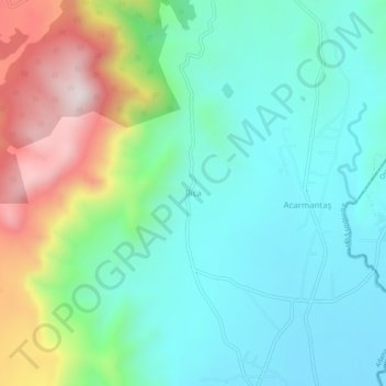
Name: Ilıca topographic map, elevation, terrain.
Location: Ilıca, Kozan, Adana, Mediterranean Region, Turkey (37.45644 35.88060 37.49644 35.92060)
Average elevation: 879 ft
Minimum elevation: 223 ft
Maximum elevation: 2,546 ft
Thank you for supporting this site ❤️
Make a donation
Make a donation
Gear up for your next adventure:
As an Amazon Associate, this site earns from qualifying purchases at no extra cost to you.