Geolocate

Tierra Monte topographic map

Click on the map to display elevation.

About this map

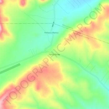
Name: Tierra Monte topographic map, elevation, terrain.

Location: Tierra Monte, San Miguel County, New Mexico, United States (35.83920 -105.36751 35.87920 -105.32751)

Average elevation: 7,569 ft

Minimum elevation: 7,283 ft

Maximum elevation: 7,949 ft

Other topographic maps

Click on a map to view its topography, its elevation and its terrain.

Las Vegas

United States > New Mexico > San Miguel County

Average elevation: 6,542 ft

Pecos

United States > New Mexico > San Miguel County

Average elevation: 6,991 ft

Las Vegas

United States > New Mexico > San Miguel County

Average elevation: 6,542 ft

Gear up for your next adventure:

👓Polarized Sunglasses - Outdoor sunglasses for glare reduction
🗺️Topographic Maps - Detailed topo maps for hiking, exploring and outdoor navigation
🛶Inflatable Kayak - Portable kayak for rivers, lakes, and expeditions
🪶Wildlife Field Guides - Learn animal tracking and species ID
🛌Ultralight Sleeping Bags - Compact down bags for cold nights in the wilderness

As an Amazon Associate, this site earns from qualifying purchases at no extra cost to you.