
Town of Mayerthorpe topographic map
Interactive map
Click on the map to display elevation.
About this map
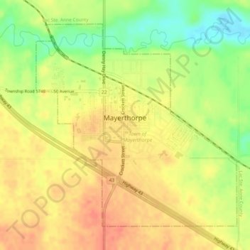
Name: Town of Mayerthorpe topographic map, elevation, terrain.
Average elevation: 2,333 ft
Minimum elevation: 2,234 ft
Maximum elevation: 2,395 ft
Other topographic maps
Click on a map to view its topography, its elevation and its terrain.
Grassland
Canada > Alberta > Division No. 13
Grassland, Division No. 13, Alberta, T0A 1V0, Canada
Average elevation: 1,916 ft