
Thank you for supporting this site ❤️
Make a donation
Make a donation
Gear up for your next adventure:
As an Amazon Associate, this site earns from qualifying purchases at no extra cost to you.
Marloie topographic map
Click on the map to display elevation.
Thank you for supporting this site ❤️
Make a donation
Make a donation
Gear up for your next adventure:
As an Amazon Associate, this site earns from qualifying purchases at no extra cost to you.
About this map
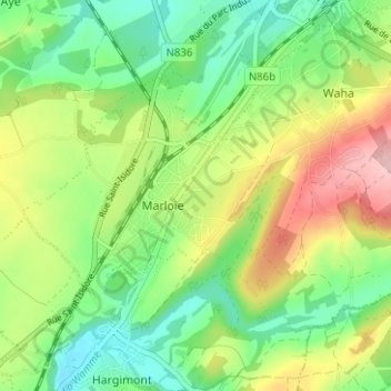
Name: Marloie topographic map, elevation, terrain.
Location: Marloie, Marche-en-Famenne, Luxembourg, Wallonie, 6900, Belgique (50.18042 5.29603 50.22042 5.33603)
Average elevation: 886 ft
Minimum elevation: 676 ft
Maximum elevation: 1,198 ft
Thank you for supporting this site ❤️
Make a donation
Make a donation
Gear up for your next adventure:
As an Amazon Associate, this site earns from qualifying purchases at no extra cost to you.