Geolocate

Cochrane topographic map

Click on the map to display elevation.

About this map

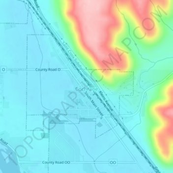
Name: Cochrane topographic map, elevation, terrain.

Location: Cochrane, Buffalo County, Wisconsin, United States (44.21972 -91.84827 44.23593 -91.82498)

Average elevation: 781 ft

Minimum elevation: 646 ft

Maximum elevation: 1,237 ft

Buffalo County trails, hiking, mountain biking, running and outdoor activities

Other topographic maps

Click on a map to view its topography, its elevation and its terrain.

Cream

United States > Wisconsin > Buffalo County

Average elevation: 958 ft

Trevino

United States > Wisconsin > Buffalo County

Average elevation: 676 ft

Gear up for your next adventure:

🪵Folding Camp Saw - Compact saw for wood and campsite work
🛠️Backpacking Tool Kit - Essential toolkit for outdoor repairs
📡Handheld GPS Device - Reliable handheld GPS for outdoor navigation
🧭Compass with Lanyard - Easy‑carry compass for navigation
🧦Merino Wool Socks - Moisture-wicking, blister-preventing socks for long treks

As an Amazon Associate, this site earns from qualifying purchases at no extra cost to you.