
Thank you for supporting this site ❤️
Make a donation
Make a donation
Gear up for your next adventure:
As an Amazon Associate, this site earns from qualifying purchases at no extra cost to you.
Guatire topographic map
Click on the map to display elevation.
Thank you for supporting this site ❤️
Make a donation
Make a donation
Gear up for your next adventure:
As an Amazon Associate, this site earns from qualifying purchases at no extra cost to you.
About this map
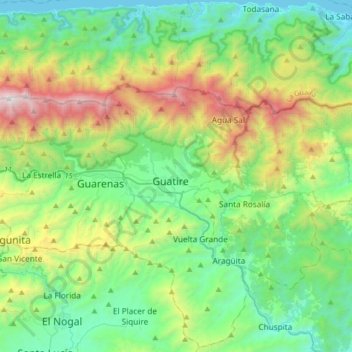
Name: Guatire topographic map, elevation, terrain.
Location: Guatire, Municipio Zamora, Estado Miranda, 1221, Venezuela (10.30846 -66.70311 10.62846 -66.38311)
Average elevation: 2,110 ft
Minimum elevation: -13 ft
Maximum elevation: 7,592 ft
Thank you for supporting this site ❤️
Make a donation
Make a donation
Gear up for your next adventure:
As an Amazon Associate, this site earns from qualifying purchases at no extra cost to you.