
Geiselbach topographic map
Click on the map to display elevation.
Geiselbach
Die Gemeinde liegt im Kahlgrund direkt an der bayerisch/hessischen Landesgrenze, 20 km nördlich von Aschaffenburg, 50 km östlich von Frankfurt am Main auf 272 m ü. NHN. Der topographisch höchste Punkt der Gemeinde befindet sich am Gipfel des Kreuzberges 388 m ü. NHN (Lage)50.13079.20179, der niedrigste liegt im Teufelsgrund auf 179 m ü. NHN (Lage)50.099989.15917.
About this map
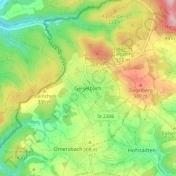
Name: Geiselbach topographic map, elevation, terrain.
Location: Geiselbach, Landkreis Aschaffenburg, Bayern, 63826, Deutschland (50.10271 9.17847 50.14271 9.21847)
Average elevation: 971 ft
Minimum elevation: 630 ft
Maximum elevation: 1,450 ft