
Make a donation
Gear up for your next adventure:
As an Amazon Associate, this site earns from qualifying purchases at no extra cost to you.
Red Hill Fire Tower topographic map
Click on the map to display elevation.
Make a donation
Gear up for your next adventure:
As an Amazon Associate, this site earns from qualifying purchases at no extra cost to you.
Red Hill Fire Tower
The cabin is a small, one-story, 14-by-24-foot (4.3 by 7.3 m) gable-roofed frame building. It is sided with "brainstorm", edge board stained reddish brown. It has a mortared rubblestone foundation and a covered porch on the south elevation, originally decked in wood but since replaced with concrete. Built in 1931, it is one of the oldest remaining observer's cabins in New York, a rare intact example of the earlier style used by the then-state Conservation Commission.
Make a donation
Gear up for your next adventure:
As an Amazon Associate, this site earns from qualifying purchases at no extra cost to you.
About this map
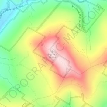
Name: Red Hill Fire Tower topographic map, elevation, terrain.
Average elevation: 2,339 ft
Minimum elevation: 1,762 ft
Maximum elevation: 2,972 ft
Ulster County trails, hiking, mountain biking, running and outdoor activities
Make a donation
Gear up for your next adventure:
As an Amazon Associate, this site earns from qualifying purchases at no extra cost to you.