
Thank you for supporting this site ❤️
Make a donation
Make a donation
Gear up for your next adventure:
As an Amazon Associate, this site earns from qualifying purchases at no extra cost to you.
Puentelon topographic map
Click on the map to display elevation.
Thank you for supporting this site ❤️
Make a donation
Make a donation
Gear up for your next adventure:
As an Amazon Associate, this site earns from qualifying purchases at no extra cost to you.
About this map
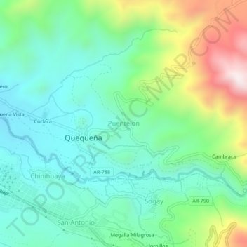
Name: Puentelon topographic map, elevation, terrain.
Location: Puentelon, Quequeña, Provincia de Arequipa, Arequipa, Perú (-16.57577 -71.46426 -16.53577 -71.42426)
Average elevation: 8,878 ft
Minimum elevation: 8,153 ft
Maximum elevation: 10,669 ft
Thank you for supporting this site ❤️
Make a donation
Make a donation
Gear up for your next adventure:
As an Amazon Associate, this site earns from qualifying purchases at no extra cost to you.