
Thank you for supporting this site ❤️
Make a donation
Make a donation
Gear up for your next adventure:
As an Amazon Associate, this site earns from qualifying purchases at no extra cost to you.
Benllera topographic map
Click on the map to display elevation.
Thank you for supporting this site ❤️
Make a donation
Make a donation
Gear up for your next adventure:
As an Amazon Associate, this site earns from qualifying purchases at no extra cost to you.
About this map
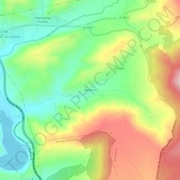
Name: Benllera topographic map, elevation, terrain.
Location: Benllera, Carrocera, León, Castilla y León, 24123, España (42.75136 -5.77609 42.79136 -5.73609)
Average elevation: 3,543 ft
Minimum elevation: 3,143 ft
Maximum elevation: 4,104 ft
Thank you for supporting this site ❤️
Make a donation
Make a donation
Gear up for your next adventure:
As an Amazon Associate, this site earns from qualifying purchases at no extra cost to you.