
Thank you for supporting this site ❤️
Make a donation
Make a donation
Gear up for your next adventure:
As an Amazon Associate, this site earns from qualifying purchases at no extra cost to you.
Chalhuanca topographic map
Click on the map to display elevation.
Thank you for supporting this site ❤️
Make a donation
Make a donation
Gear up for your next adventure:
As an Amazon Associate, this site earns from qualifying purchases at no extra cost to you.
About this map
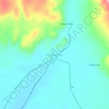
Name: Chalhuanca topographic map, elevation, terrain.
Location: Chalhuanca, Yanque, Provincia de Caylloma, Arequipa, Perú (-15.73708 -71.33937 -15.69708 -71.29937)
Average elevation: 14,318 ft
Minimum elevation: 14,163 ft
Maximum elevation: 14,839 ft
Thank you for supporting this site ❤️
Make a donation
Make a donation
Gear up for your next adventure:
As an Amazon Associate, this site earns from qualifying purchases at no extra cost to you.