
Thank you for supporting this site ❤️
Make a donation
Make a donation
Gear up for your next adventure:
As an Amazon Associate, this site earns from qualifying purchases at no extra cost to you.
Castegnate topographic map
Click on the map to display elevation.
Thank you for supporting this site ❤️
Make a donation
Make a donation
Gear up for your next adventure:
As an Amazon Associate, this site earns from qualifying purchases at no extra cost to you.
About this map
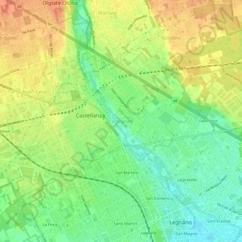
Name: Castegnate topographic map, elevation, terrain.
Location: Castegnate, Castellanza, Varese, Lombardy, 21053, Italy (45.59140 8.88429 45.63140 8.92429)
Average elevation: 725 ft
Minimum elevation: 650 ft
Maximum elevation: 801 ft
Thank you for supporting this site ❤️
Make a donation
Make a donation
Gear up for your next adventure:
As an Amazon Associate, this site earns from qualifying purchases at no extra cost to you.