
Thank you for supporting this site ❤️
Make a donation
Make a donation
Gear up for your next adventure:
As an Amazon Associate, this site earns from qualifying purchases at no extra cost to you.
BAZINA topographic map
Click on the map to display elevation.
Thank you for supporting this site ❤️
Make a donation
Make a donation
Gear up for your next adventure:
As an Amazon Associate, this site earns from qualifying purchases at no extra cost to you.
About this map
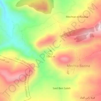
Name: BAZINA topographic map, elevation, terrain.
Location: BAZINA, Bouhachana, Daïra Khezara, Guelma, 24015, Algérie (36.28304 7.48864 36.28314 7.48874)
Average elevation: 2,815 ft
Minimum elevation: 2,028 ft
Maximum elevation: 3,474 ft
Thank you for supporting this site ❤️
Make a donation
Make a donation
Gear up for your next adventure:
As an Amazon Associate, this site earns from qualifying purchases at no extra cost to you.