Geolocate

Ashtarak topographic map

Click on the map to display elevation.

About this map

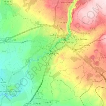
Name: Ashtarak topographic map, elevation, terrain.

Location: Ashtarak, Ashtarak region, Aragatsotn Province, 0204, Armenia (40.24868 44.32131 40.32868 44.40131)

Average elevation: 3,822 ft

Minimum elevation: 3,258 ft

Maximum elevation: 4,524 ft

Gear up for your next adventure:

⛑️Personal Locator Beacon - Safety beacon for emergencies
🧢Sun Protection Hats - Wide-brimmed and UPF-rated hats for high-altitude sun safety
📻Weather Alert Radios - Stay informed of storm risks while off-the-grid
📶Vehicle Signal Boosters - Improve reception in rural areas while driving to trailheads
🔋Rechargeable Batteries - Power up your outdoor devices

As an Amazon Associate, this site earns from qualifying purchases at no extra cost to you.