
Thank you for supporting this site ❤️
Make a donation
Make a donation
Gear up for your next adventure:
As an Amazon Associate, this site earns from qualifying purchases at no extra cost to you.
Withcott topographic map
Click on the map to display elevation.
Thank you for supporting this site ❤️
Make a donation
Make a donation
Gear up for your next adventure:
As an Amazon Associate, this site earns from qualifying purchases at no extra cost to you.
About this map
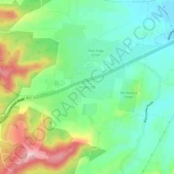
Name: Withcott topographic map, elevation, terrain.
Location: Withcott, Lockyer Valley Regional, Queensland, Australia (-27.57459 152.00662 -27.53459 152.04662)
Average elevation: 938 ft
Minimum elevation: 656 ft
Maximum elevation: 1,476 ft
Thank you for supporting this site ❤️
Make a donation
Make a donation
Gear up for your next adventure:
As an Amazon Associate, this site earns from qualifying purchases at no extra cost to you.