Geolocate

Palca topographic map

Click on the map to display elevation.

About this map

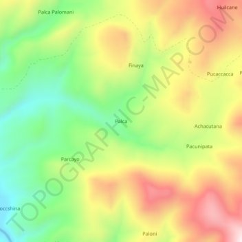
Name: Palca topographic map, elevation, terrain.

Location: Palca, Callalli, Provincia de Caylloma, Arequipa, Perú (-15.52202 -71.18994 -15.48202 -71.14994)

Average elevation: 14,780 ft

Minimum elevation: 13,927 ft

Maximum elevation: 15,751 ft

Gear up for your next adventure:

🍳Camping Cook Set - Complete cookware for outdoor meals
👟Men's Trail Runners - Lightweight footwear for fast-paced exploration and light hiking
🧦Hiking Socks - Comfortable socks to prevent blisters on long hikes
🪶Survival Guide Book - Expert advice for emergency preparedness
🧺Microfiber Travel Towels - Compact and fast-drying towels for trail use

As an Amazon Associate, this site earns from qualifying purchases at no extra cost to you.