Geolocate

Lenox topographic map

Click on the map to display elevation.

About this map

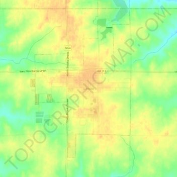
Name: Lenox topographic map, elevation, terrain.

Location: Lenox, Taylor County, Iowa, 50851, United States (40.86130 -94.57889 40.90130 -94.53889)

Average elevation: 1,276 ft

Minimum elevation: 1,211 ft

Maximum elevation: 1,319 ft

Taylor County trails, hiking, mountain biking, running and outdoor activities

Gear up for your next adventure:

💧Water Filtration Bottles - Safely drink from streams and lakes while exploring
☀️Outdoor Sunscreen - High protection sunscreen for outdoor activities
👓Polarized Sunglasses - Outdoor sunglasses for glare reduction
🥄Camping Utensil Set - Lightweight utensils for outdoor meals
🛡️Insect Repellent - Protection against bugs during outdoor activities

As an Amazon Associate, this site earns from qualifying purchases at no extra cost to you.