
Make a donation
Gear up for your next adventure:
As an Amazon Associate, this site earns from qualifying purchases at no extra cost to you.
Pocona topographic map
Click on the map to display elevation.
Make a donation
Gear up for your next adventure:
As an Amazon Associate, this site earns from qualifying purchases at no extra cost to you.
Pocona
Pocona ist zentraler Ort des Landkreises (bolivianisch: Municipio) Pocona in der Provinz Carrasco. Die Ortschaft liegt auf einer Höhe von 2721 m am rechten Ufer des Río Pocona Mayu, der in südöstlicher Richtung zum Río Mizque hin entwässert.
Make a donation
Gear up for your next adventure:
As an Amazon Associate, this site earns from qualifying purchases at no extra cost to you.
About this map
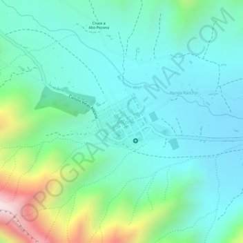
Name: Pocona topographic map, elevation, terrain.
Location: Pocona, Municipio Pocona, Cochabamba, Bolivien (-17.67794 -65.42354 -17.67157 -65.41450)
Average elevation: 9,177 ft
Minimum elevation: 8,632 ft
Maximum elevation: 10,807 ft
Make a donation
Gear up for your next adventure:
As an Amazon Associate, this site earns from qualifying purchases at no extra cost to you.