
Thank you for supporting this site ❤️
Make a donation
Make a donation
Gear up for your next adventure:
As an Amazon Associate, this site earns from qualifying purchases at no extra cost to you.
Bouyala topographic map
Click on the map to display elevation.
Thank you for supporting this site ❤️
Make a donation
Make a donation
Gear up for your next adventure:
As an Amazon Associate, this site earns from qualifying purchases at no extra cost to you.
About this map
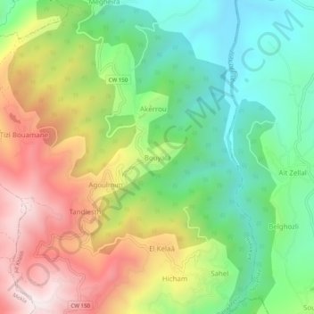
Name: Bouyala topographic map, elevation, terrain.
Location: Bouyala, Aït Khelili, Daïra Mekla, Tizi Ouzou, Algérie (36.64137 4.29663 36.68137 4.33663)
Average elevation: 1,818 ft
Minimum elevation: 712 ft
Maximum elevation: 3,389 ft
Thank you for supporting this site ❤️
Make a donation
Make a donation
Gear up for your next adventure:
As an Amazon Associate, this site earns from qualifying purchases at no extra cost to you.