Geolocate

Murphy topographic map

Click on the map to display elevation.

About this map

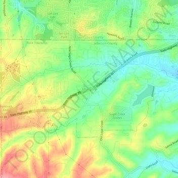
Name: Murphy topographic map, elevation, terrain.

Location: Murphy, Jefferson County, Missouri, 63049, United States (38.47013 -90.50722 38.51013 -90.46722)

Average elevation: 607 ft

Minimum elevation: 459 ft

Maximum elevation: 801 ft

Jefferson County trails, hiking, mountain biking, running and outdoor activities

Gear up for your next adventure:

🪄Magnetic Compass - Accurate compass for navigation
🎒Gear Packing Cubes - Organize your backpack efficiently
🏕️Tent Footprint - Protect your tent base from wear
🛏️Cold Weather Sleeping Bag - Warm sleeping bag for cold conditions
🎒Waterproof Dry Bags - Keep your electronics and maps dry inside your pack

As an Amazon Associate, this site earns from qualifying purchases at no extra cost to you.