
Thank you for supporting this site ❤️
Make a donation
Make a donation
Gear up for your next adventure:
As an Amazon Associate, this site earns from qualifying purchases at no extra cost to you.
Sequeiros topographic map
Click on the map to display elevation.
Thank you for supporting this site ❤️
Make a donation
Make a donation
Gear up for your next adventure:
As an Amazon Associate, this site earns from qualifying purchases at no extra cost to you.
About this map
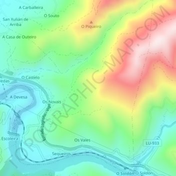
Name: Sequeiros topographic map, elevation, terrain.
Location: Sequeiros, Quiroga, Lugo, Galicia, España (42.44423 -7.25099 42.47181 -7.22163)
Average elevation: 1,342 ft
Minimum elevation: 755 ft
Maximum elevation: 2,431 ft
Thank you for supporting this site ❤️
Make a donation
Make a donation
Gear up for your next adventure:
As an Amazon Associate, this site earns from qualifying purchases at no extra cost to you.