
Rathangan topographic map
Click on the map to display elevation.
About this map
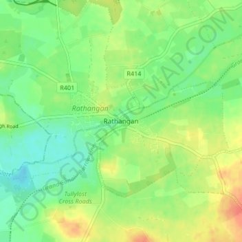
Name: Rathangan topographic map, elevation, terrain.
Location: Rathangan, County Kildare, Leinster, Ireland (53.20033 -7.01297 53.24033 -6.97297)
Average elevation: 249 ft
Minimum elevation: 190 ft
Maximum elevation: 328 ft