
Thank you for supporting this site ❤️
Make a donation
Make a donation
Gear up for your next adventure:
As an Amazon Associate, this site earns from qualifying purchases at no extra cost to you.
Kahama topographic map
Click on the map to display elevation.
Thank you for supporting this site ❤️
Make a donation
Make a donation
Gear up for your next adventure:
As an Amazon Associate, this site earns from qualifying purchases at no extra cost to you.
About this map
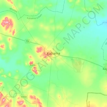
Name: Kahama topographic map, elevation, terrain.
Location: Kahama, Kahama Urban, Shinyanga Region, Lake Zone, Tanzania (-3.98899 32.44116 -3.66899 32.76116)
Average elevation: 3,967 ft
Minimum elevation: 3,802 ft
Maximum elevation: 4,462 ft
Thank you for supporting this site ❤️
Make a donation
Make a donation
Gear up for your next adventure:
As an Amazon Associate, this site earns from qualifying purchases at no extra cost to you.
Other topographic maps
Click on a map to view its topography, its elevation and its terrain.