

Bromsgrove topographic map
Click on the map to display elevation.
Bromsgrove
The solid geology of Bromsgrove is that of the Triassic (late Scythian to early Ladinian) Bromsgrove Sandstone. It shows red bed facies and was probably laid down by rivers flowing through an arid landscape or in ephemeral, shallow lakes. The uppermost beds were deposited by a brief marine transgression. The soil is very good for market gardening and growing vegetables due to Marl bands. The district is at a general elevation of between 200 feet (61 m) to 300 feet (91 m) above sea level.
About this map
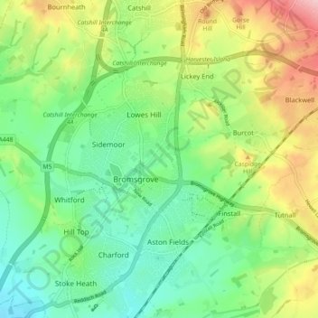
Name: Bromsgrove topographic map, elevation, terrain.
Average elevation: 390 ft
Minimum elevation: 184 ft
Maximum elevation: 764 ft