Geolocate

Emilia topographic map

Click on the map to display elevation.

About this map

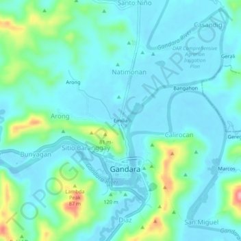
Name: Emilia topographic map, elevation, terrain.

Location: Emilia, Gandara, Samar, Eastern Visayas, 6706, Philippines (12.00131 124.79068 12.04131 124.83068)

Average elevation: 92 ft

Minimum elevation: -23 ft

Maximum elevation: 482 ft

Gear up for your next adventure:

🗺️Topographic Maps - Detailed topo maps for hiking, exploring and outdoor navigation
🥇GPS Hiking Watch - Multi‑sport GPS watch with navigation and trail tracking
🦺Reflective Outdoor Gear - Safety gear for low‑light conditions
🔭Stargazing Telescopes - Perfect for camping in low-light pollution areas shown on maps
🎒Day Hiking Backpack - Lightweight backpack perfect for day trips and outdoor adventures

As an Amazon Associate, this site earns from qualifying purchases at no extra cost to you.