Geolocate

Iba topographic map

Click on the map to display elevation.

About this map

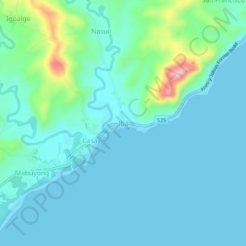
Name: Iba topographic map, elevation, terrain.

Location: Iba, Anini-y, Antique, Western Visayas, Philippines (10.42214 121.98160 10.46214 122.02160)

Average elevation: 105 ft

Minimum elevation: 0 ft

Maximum elevation: 646 ft

Gear up for your next adventure:

🪶Trail Camera - Capture wildlife on your hikes
🔭Telescopic Hiking Pole - Adjustable pole for hiking stability
🎁Geography Themed Gifts - Unique gift ideas for map lovers and geography enthusiasts
🦶Hiking Gaiters - Keep debris and water out of your boots
🚪Portable Camp Chair - Foldable chair for comfort at camp

As an Amazon Associate, this site earns from qualifying purchases at no extra cost to you.