Geolocate

Libjo topographic map

Click on the map to display elevation.

About this map

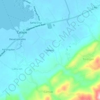
Name: Libjo topographic map, elevation, terrain.

Location: Libjo, Calape, Bohol, Central Visayas, 6328, Philippines (9.86333 123.86333 9.90333 123.90333)

Average elevation: 144 ft

Minimum elevation: -10 ft

Maximum elevation: 942 ft

Other topographic maps

Click on a map to view its topography, its elevation and its terrain.

Pangangan Island

Philippines > Bohol > Calape

Average elevation: 3 ft

Gear up for your next adventure:

🏕️Family Camping Gear - Essentials for group camping trips
🛡️Bear Spray Outdoor - Protection in bear country hikes
🧦Merino Wool Socks - Moisture-wicking, blister-preventing socks for long treks
🥤Water Filter Bottle - All‑in‑one filter bottle for safe hydration
📱Heavy-Duty Phone Cases - Drop-proof and waterproof protection for outdoor navigation

As an Amazon Associate, this site earns from qualifying purchases at no extra cost to you.