
Queenston topographic map
Interactive map
Click on the map to display elevation.
About this map
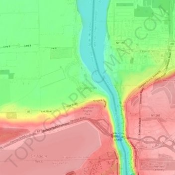
Name: Queenston topographic map, elevation, terrain.
Average elevation: 436 ft
Minimum elevation: 200 ft
Maximum elevation: 630 ft
Other topographic maps
Click on a map to view its topography, its elevation and its terrain.
Queenston Heights Park
Canada > Ontario > Niagara Region > Niagara-on-the-Lake > Queenston
Queenston Heights Park, Queenston, Niagara-on-the-Lake, Niagara Region, Golden Horseshoe, Ontario, L0S 1L0, Canada
Average elevation: 456 ft
Niagara-on-the-Lake
Canada > Ontario > Niagara Region > Niagara-on-the-Lake
Niagara-on-the-Lake, Niagara Region, Golden Horseshoe, Ontario, L0S 1J0, Canada
Average elevation: 269 ft