Geolocate

Torres topographic map

Click on the map to display elevation.

About this map

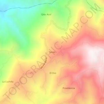
Name: Torres topographic map, elevation, terrain.

Location: Torres, La Sierra, Macizo, Cauca, RAP Pacífico, Colombia (2.18608 -76.75689 2.22608 -76.71689)

Average elevation: 5,771 ft

Minimum elevation: 3,786 ft

Maximum elevation: 7,359 ft

Gear up for your next adventure:

🧭Hiking Compass - Precision compass for reliable navigation in the wilderness
🧯Emergency Survival Kit - All‑in‑one survival essentials for the backcountry
GPS Sports Watch - GPS watch for running, hiking and training
👖Convertible Hiking Pants - Versatile zip-off pants for changing altitudes and temperatures
🛶Inflatable Kayak - Portable kayak for rivers, lakes, and expeditions

As an Amazon Associate, this site earns from qualifying purchases at no extra cost to you.