
Frade topographic map
Interactive map
Click on the map to display elevation.
About this map
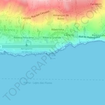
Name: Frade topographic map, elevation, terrain.
Location: Frade, Castelo Branco, Horta, Açores, 9900-330, Portugal (38.51830 -28.70776 38.51840 -28.70766)
Average elevation: 154 ft
Minimum elevation: 0 ft
Maximum elevation: 692 ft
Other topographic maps
Click on a map to view its topography, its elevation and its terrain.
Lombega
Portugal > Castelo Branco > Lombega
Lombega, Castelo Branco, Horta, Açores, Portugal
Average elevation: 509 ft