
Thank you for supporting this site ❤️
Make a donation
Make a donation
Gear up for your next adventure:
As an Amazon Associate, this site earns from qualifying purchases at no extra cost to you.
Alamboo topographic map
Click on the map to display elevation.
Thank you for supporting this site ❤️
Make a donation
Make a donation
Gear up for your next adventure:
As an Amazon Associate, this site earns from qualifying purchases at no extra cost to you.
About this map
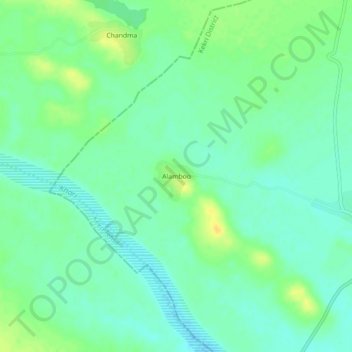
Name: Alamboo topographic map, elevation, terrain.
Location: Alamboo, Kekri Tehsil, Ajmer District, Rajasthan, India (25.79086 75.00559 25.83086 75.04559)
Average elevation: 1,165 ft
Minimum elevation: 1,132 ft
Maximum elevation: 1,211 ft
Thank you for supporting this site ❤️
Make a donation
Make a donation
Gear up for your next adventure:
As an Amazon Associate, this site earns from qualifying purchases at no extra cost to you.