
Thank you for supporting this site ❤️
Make a donation
Make a donation
Gear up for your next adventure:
As an Amazon Associate, this site earns from qualifying purchases at no extra cost to you.
业州镇 topographic map
Click on the map to display elevation.
Thank you for supporting this site ❤️
Make a donation
Make a donation
Gear up for your next adventure:
As an Amazon Associate, this site earns from qualifying purchases at no extra cost to you.
About this map
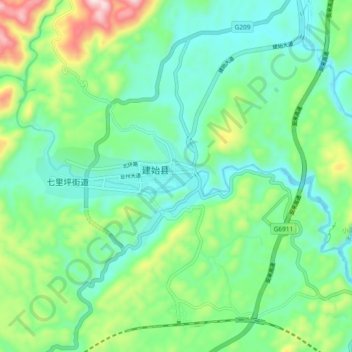
Name: 业州镇 topographic map, elevation, terrain.
Location: 业州镇, 建始县, 恩施土家族苗族自治州, 湖北省, 中国 (30.56319 109.68271 30.64319 109.76271)
Average elevation: 2,159 ft
Minimum elevation: 1,713 ft
Maximum elevation: 3,373 ft
Thank you for supporting this site ❤️
Make a donation
Make a donation
Gear up for your next adventure:
As an Amazon Associate, this site earns from qualifying purchases at no extra cost to you.