
Thank you for supporting this site ❤️
Make a donation
Make a donation
Gear up for your next adventure:
As an Amazon Associate, this site earns from qualifying purchases at no extra cost to you.
Cascajal topographic map
Click on the map to display elevation.
Thank you for supporting this site ❤️
Make a donation
Make a donation
Gear up for your next adventure:
As an Amazon Associate, this site earns from qualifying purchases at no extra cost to you.
About this map
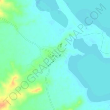
Name: Cascajal topographic map, elevation, terrain.
Location: Cascajal, Magangué, Mojana, Bolívar, Colombia (9.29497 -74.82651 9.33497 -74.78651)
Average elevation: 59 ft
Minimum elevation: 33 ft
Maximum elevation: 154 ft
Thank you for supporting this site ❤️
Make a donation
Make a donation
Gear up for your next adventure:
As an Amazon Associate, this site earns from qualifying purchases at no extra cost to you.