Geolocate

Wolf topographic map

Interactive map

Click on the map to display elevation.

About this map

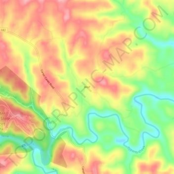
Name: Wolf topographic map, elevation, terrain.

Location: Wolf, Carter County, Kentucky, United States (38.35925 -83.11934 38.39925 -83.07934)

Average elevation: 889 ft

Minimum elevation: 673 ft

Maximum elevation: 1,066 ft

Other topographic maps

Click on a map to view its topography, its elevation and its terrain.

Grayson

United States > Kentucky > Carter County

Grayson, Carter County, Kentucky, United States

Average elevation: 682 ft

Denton

United States > Kentucky > Carter County

Denton, Carter County, Kentucky, 41132, United States

Average elevation: 761 ft

Hitchins

United States > Kentucky > Carter County

Hitchins, Carter County, Kentucky, 41146, United States

Average elevation: 705 ft

Grahn

United States > Kentucky > Carter County

Grahn, Carter County, Kentucky, 41142, United States

Average elevation: 873 ft

Olive Hill

United States > Kentucky > Carter County

Olive Hill, Carter County, Kentucky, 41164, United States

Average elevation: 899 ft