
Thank you for supporting this site ❤️
Make a donation
Make a donation
Gear up for your next adventure:
As an Amazon Associate, this site earns from qualifying purchases at no extra cost to you.
Retterswil topographic map
Click on the map to display elevation.
Thank you for supporting this site ❤️
Make a donation
Make a donation
Gear up for your next adventure:
As an Amazon Associate, this site earns from qualifying purchases at no extra cost to you.
About this map
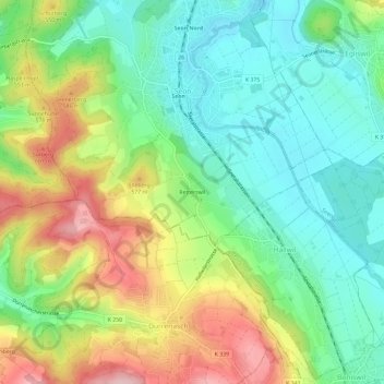
Name: Retterswil topographic map, elevation, terrain.
Location: Retterswil, Seon, Bezirk Lenzburg, Aargau, 5703, Schweiz (47.31545 8.14080 47.35545 8.18080)
Average elevation: 1,670 ft
Minimum elevation: 1,417 ft
Maximum elevation: 2,090 ft
Thank you for supporting this site ❤️
Make a donation
Make a donation
Gear up for your next adventure:
As an Amazon Associate, this site earns from qualifying purchases at no extra cost to you.