
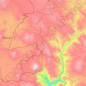
Ubinas topographic map
Interactive map
Click on the map to display elevation.
Ubinas topographic map, elevation, terrain
About this map
Name: Ubinas topographic map, elevation, terrain.
Location: Ubinas, General Sánchez Cerro, Moquegua, Perú (-16.44751 -70.98656 -15.97596 -70.65599)
Average elevation: 14,324 ft
Minimum elevation: 8,396 ft
Maximum elevation: 18,428 ft
Other topographic maps
Click on a map to view its topography, its elevation and its terrain.
Volcán Ubinas
El 10 de mayo, mientras que la actividad se había detenido por dos 2 semanas, se produjeron nuevamente dos explosiones. La primera proyectó cenizas hasta 1 200 metros de altitud. La segunda proyectó bombas hasta 1 km (contra 500 metros en el momento de las explosiones precedentes). Las localidades de…
Average elevation: 16,975 ft