
Big Indian topographic map
Click on the map to display elevation.
About this map
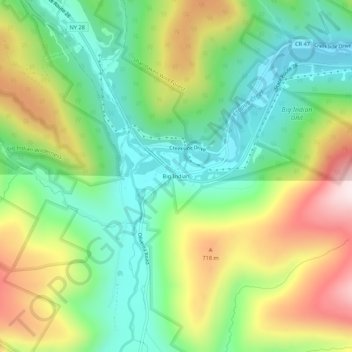
Name: Big Indian topographic map, elevation, terrain.
Average elevation: 1,762 ft
Minimum elevation: 1,102 ft
Maximum elevation: 2,838 ft
Ulster County trails, hiking, mountain biking, running and outdoor activities
Other topographic maps
Click on a map to view its topography, its elevation and its terrain.
Phoenicia
United States > New York > Ulster County > Town of Shandaken > Phoenicia
Average elevation: 1,145 ft
Catskills Visitor Center
United States > New York > Ulster County > Town of Shandaken > Beechford
Average elevation: 988 ft
Woodland Valley Campground
United States > New York > Ulster County > Town of Shandaken
Average elevation: 1,854 ft