
白碉苗族乡 topographic map
Interactive map
Click on the map to display elevation.
About this map
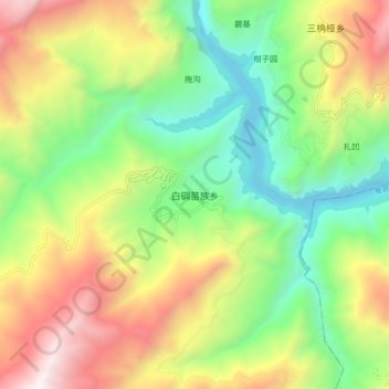
Name: 白碉苗族乡 topographic map, elevation, terrain.
Location: 白碉苗族乡, 木里藏族自治县, 凉山彝族自治州, 四川省, 中国 (28.01366 101.41874 28.09366 101.49874)
Average elevation: 8,087 ft
Minimum elevation: 5,463 ft
Maximum elevation: 11,942 ft
Other topographic maps
Click on a map to view its topography, its elevation and its terrain.