Geolocate

Paute topographic map

Click on the map to display elevation.

About this map

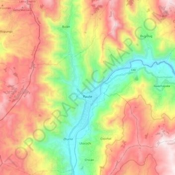
Name: Paute topographic map, elevation, terrain.

Location: Paute, Azuay, Ecuador (-2.83071 -78.82322 -2.71689 -78.74108)

Average elevation: 8,911 ft

Minimum elevation: 7,014 ft

Maximum elevation: 10,814 ft

Gear up for your next adventure:

🧯Emergency Survival Kit - All‑in‑one survival essentials for the backcountry
🛠️Outdoor Gear Repair Kit - Essential tools to fix gear on the trail
🦺Reflective Outdoor Gear - Safety gear for low‑light conditions
🌄Hiking Binoculars - Compact binoculars for scenic views and trail spotting
🛠️Backpacking Tool Kit - Essential toolkit for outdoor repairs

As an Amazon Associate, this site earns from qualifying purchases at no extra cost to you.