
Sangudo topographic map
Interactive map
Click on the map to display elevation.
About this map
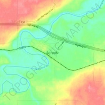
Name: Sangudo topographic map, elevation, terrain.
Location: Sangudo, Lac Ste. Anne County, Alberta, T0E 2A0, Canada (53.86634 -114.91643 53.90634 -114.87643)
Average elevation: 2,254 ft
Minimum elevation: 2,146 ft
Maximum elevation: 2,402 ft