
Make a donation
Gear up for your next adventure:
As an Amazon Associate, this site earns from qualifying purchases at no extra cost to you.
Deck topographic map
Click on the map to display elevation.
Make a donation
Gear up for your next adventure:
As an Amazon Associate, this site earns from qualifying purchases at no extra cost to you.
About this map
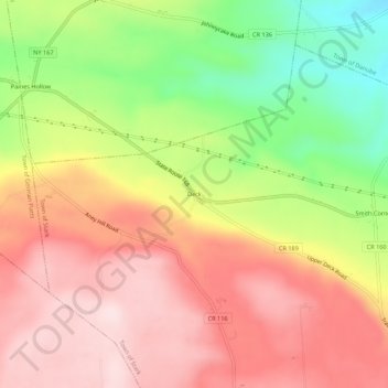
Name: Deck topographic map, elevation, terrain.
Average elevation: 1,312 ft
Minimum elevation: 689 ft
Maximum elevation: 1,778 ft
Herkimer County trails, hiking, mountain biking, running and outdoor activities
Make a donation
Gear up for your next adventure:
As an Amazon Associate, this site earns from qualifying purchases at no extra cost to you.
Other topographic maps
Click on a map to view its topography, its elevation and its terrain.
Dolgeville Dam
United States > New York > Herkimer County > Village of Dolgeville
Average elevation: 840 ft
Make a donation
Gear up for your next adventure:
As an Amazon Associate, this site earns from qualifying purchases at no extra cost to you.
Trenton Falls - Main Dam
United States > New York > Herkimer County > Town of Russia
Average elevation: 1,053 ft
Make a donation
Gear up for your next adventure:
As an Amazon Associate, this site earns from qualifying purchases at no extra cost to you.
East Frankfort
United States > New York > Herkimer County > Town of Frankfort
Average elevation: 499 ft
Make a donation
Gear up for your next adventure:
As an Amazon Associate, this site earns from qualifying purchases at no extra cost to you.
Make a donation
Gear up for your next adventure:
As an Amazon Associate, this site earns from qualifying purchases at no extra cost to you.
Make a donation
Gear up for your next adventure:
As an Amazon Associate, this site earns from qualifying purchases at no extra cost to you.
Village of Newport
United States > New York > Herkimer County > Town of Newport
Average elevation: 771 ft
Herkimer
United States > New York > Herkimer County > Herkimer
In 1722, in response to a request by the German Palatine leaders Joseph Petrie and Conrad Rickert, Governor William Burnet granted the Palatines a lease to purchase land from the Mohawk Nation in the vicinity of the confluence of West Canada Creek and the Mohawk River. After a survey of the land was completed…
Average elevation: 505 ft
Make a donation
Gear up for your next adventure:
As an Amazon Associate, this site earns from qualifying purchases at no extra cost to you.
Big Moose Lake
United States > New York > Herkimer County > Town of Long Lake
Average elevation: 1,978 ft
Make a donation
Gear up for your next adventure:
As an Amazon Associate, this site earns from qualifying purchases at no extra cost to you.