
Thank you for supporting this site ❤️
Make a donation
Make a donation
Gear up for your next adventure:
As an Amazon Associate, this site earns from qualifying purchases at no extra cost to you.
Riverpark topographic map
Click on the map to display elevation.
Thank you for supporting this site ❤️
Make a donation
Make a donation
Gear up for your next adventure:
As an Amazon Associate, this site earns from qualifying purchases at no extra cost to you.
About this map
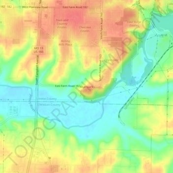
Name: Riverpark topographic map, elevation, terrain.
Location: Riverpark, Greene County, Missouri, 65810, United States (37.07783 -93.30324 37.11783 -93.26324)
Average elevation: 1,214 ft
Minimum elevation: 1,112 ft
Maximum elevation: 1,312 ft
Thank you for supporting this site ❤️
Make a donation
Make a donation
Gear up for your next adventure:
As an Amazon Associate, this site earns from qualifying purchases at no extra cost to you.