Geolocate

Tecumseh topographic map

Click on the map to display elevation.

About this map

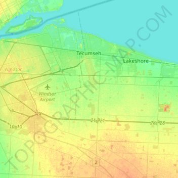
Name: Tecumseh topographic map, elevation, terrain.

Location: Tecumseh, Essex County, Ontario, Canada (42.17978 -83.00059 42.36799 -82.84079)

Average elevation: 600 ft

Minimum elevation: 564 ft

Maximum elevation: 650 ft

Other topographic maps

Click on a map to view its topography, its elevation and its terrain.

Cedar Island Park

Canada > Ontario > Essex County > Kingsville

Average elevation: 574 ft

Gear up for your next adventure:

🪑Ultralight Camp Chairs - Portable seating for resting after a long day of mapping
🪶Fire Starter Kit - Reliable fire starter for survival and camping
🥾Hiking Shoes - Durable and comfortable shoes for trail hiking
GPS Sports Watch - GPS watch for running, hiking and training
🪶Camp Gear Gift Set - Perfect gift bundle for outdoor fans

As an Amazon Associate, this site earns from qualifying purchases at no extra cost to you.