Geolocate

Vadwal topographic map

Click on the map to display elevation.

About this map

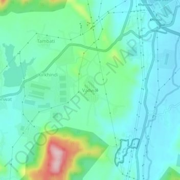
Name: Vadwal topographic map, elevation, terrain.

Location: Vadwal, Khalapur Taluka, Raigad, Maharashtra, 410202, India (18.76064 73.25302 18.80064 73.29302)

Average elevation: 335 ft

Minimum elevation: 157 ft

Maximum elevation: 971 ft

Other topographic maps

Click on a map to view its topography, its elevation and its terrain.

Patalganga

India > Maharashtra > Khalapur Taluka > Jambrung

Average elevation: 312 ft

Morbe Dam

India > Maharashtra > Khalapur Taluka > Chowk

Average elevation: 200 ft

Gear up for your next adventure:

🪶Fire Starter Kit - Reliable fire starter for survival and camping
🏕️Tent Footprint - Protect your tent base from wear
💧Water Purification System - Clean water on the trail with reliable purifiers
📖Nature Tracking Books - Learn to track wildlife and terrain
🚗GPS Dash Cams - Record your scenic drives through mountain passes and canyons

As an Amazon Associate, this site earns from qualifying purchases at no extra cost to you.